Beech trees basking in early morning sunlight near the Gale River Trail Sunday (3-18-12). The utter absence of snow on the ground in the middle of March is striking. Normally there would still be at least a few feet. Temperatures here at home scaled the high 70s through the week. Bright yellow brush strokes of forsythia blazed in back yards and beside driveways like a Christo art installation along with daffodils and trees flowering prolifically nearly three weeks earlier than normal. The Gale River road was still closed as of 3-18-12 but dry enough to bike on if you're heading to the Gale River Trail.
This is where I was heading for the day: Lakes of the Clouds on Mt. Washington, to experiment with what I hoped would be a totally cool, easy way to measure ice thicknesses in the high lakes in the White Mountains (a magic wand, so to speak). The weather forecast for Sunday in the vicinity of Mt. Washington was for lots of sun and high temps. A good chance existed that the record high temperature for the date of 37 degrees (F) set in 1945 would fall and it did as the temperature climbed to 40 degrees (F) on the summit. Warm temperatures were expected through the week so I decided to try for an ice measurement at Lakes before serious melting occurred. It was not as important to get the measurement this late in the season as it was to find an easy way to do it in the future. A week ago at Lonesome Lake, using a short handled ice chisel that I borrowed from the hut, it took an hour to chip a hole through two feet of ice. I figured the ice on the larger of the Lakes of the Clouds would be around three feet thick (36 inches). My plan was to use a 3/4 inch metal rod that I'd heat to a high temperature with a propane torch, like those used by plumbers, and use a hammer (actually a rock) to help drive the rod through the ice as I heated it repeatedly with the torch. My scheme failed miserably although I learned a bit.
 I chose the Ammonoosuc Ravine Trail for the hike up to Lakes and was greeted by this sign as I entered the parking lot at the Cog Railway Base Station. The draconian "Absolutely NO" was a bit jarring. For years the cog railway, under different owners, has worked collaboratively with the hiking community. Tensions between hikers and land owners at the periphery of the White Mountain National Forest have been rising for more than a decade as the number of hikers (and cars) has increased. A lot of hikers have not been particularly sensitive and/or respectful of the rights of the private land owners, particularly around parking issues, which is where a lot of the tension sits, but at stake is the whole concept of accessibility to the forest (public lands) and how that will be managed in the future. I know I've mentioned this a few times in this blog, but as years pass the distance between the hikers wanting access to the national forest and landowners will grow more desperate and the forest service will end up spending more money on changes in trail access, parking, etc. I hope we can secure access to all trails for the future.
 As it was the parking lot at the base station was nearly full. I was running a little late after a long drive so skiers were already on the mountain trying to stay ahead of the heat that was coming and before the snow turned to "mashed potatoes" or worse. Herds of hikers, too, were heading up to towards the Ammonoosuc Ravine and Jewel Trails as I drove into the parking lot a little after 9 am. The Dartmouth Range is in the back ground with Mt. Mitten, right, Mt. Dartmouth (middle) and Mt. Deception.
 It's hard to believe that it's been more than a year and a half since I've been to Lakes of the Clouds. It certainly doesn't seem that long but then I was on the lower "Ammy" back in September after Hurricane Irene. It was stunning to be hiking it again.
 There was a lot of snow at this elevation (about 2750' asl) with 3-4 feet on the sides of the trail. The trail has been well packed and sculpted by skiers descending from the the upper regions of the mountain Saturday afternoon.
 The lower section of the Ammonsoosuc River with the debris from the massive 2010 avalanche still plainly visible. The storm surge of Hurricane Irene removed some of the debris but there's still ample evidence of the power of the avalanche.
Once past Gem Pool, climbing steeply through these impressive balsam firs there is that familiar feeling of being on the mountain and that sense of being in a sanctuary. There was an impressive amount of snow in this tree-shaded, northwest-facing flank of the mountain. I post-holed in over my hip in one faulty step.
 The rewards for all the hard, steep climbing are sweet! The Ammonoosuc cascades down beside and across the trail a few times and just ahead is the transition from forest to "treeline" and the nearly treeless alpine zone.
 Looking west and a bit towards the north is this fine view towards the base station and across to the Dartmouth Range with Cherry Mountain just behind Mt. Desolation. Vermont and Quebec are in the distance.
 A few more steep yards uphill and the summit casually greets you with this view.
 Lakes of the Clouds Hut.
 The summit from the back of the hut.
 Given some lower temperatures, but certainly not on this Sunday, this could become a glacier in time. It's a vast areas of ice, a formation emerging from the overflow from the larger of Lakes of the Clouds.
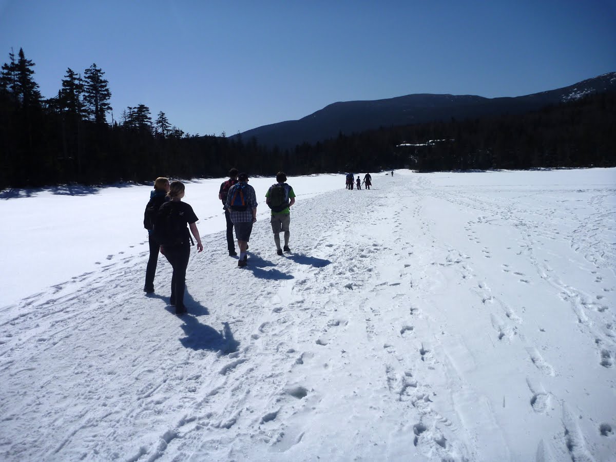
 There were a few people on the trail above the hut slabbing towards the summit and others enjoying the sun and wind protection of the hut. A number of hikers were scrambling up Mt. Monroe. I'd hiked the last 1/2 miles with a couple from Long Island that are frequent visitors to the region and who set the tone for the day with their infatuation with the mountains and their refreshing sense of humor.
 I'm an inveterate "gear head" and am genuinely impressed with how savvy hikers are becoming and fortunate to have the newer, lighter, warmer equipment available. I usually focus on what's most sustainable, e.g. what's most durable and then what's most sustaining, e.g. what provides essential warmth, wind and precip protection, plus low weight, etc.
 This group is a good illustration of what I mean by quality gear with Kahtoola micro-spikes on their boots (almost everyone hiking on Sunday wore Kahtoola micros as opposed to crampons, etc.), the windproof vests and pants, and base layers of merino wool. The high tech revolution and return of merino wool has produced great clothes for hikers and skiers: it's being used in everything from base layers to mittens, gloves, pullovers sweaters, as well as durable outerwear. We always used to say wool was the best protection in the mountains because it keeps you warm even when its wet.
 This group looked like they stepped out of an ad for Alpine skiing and riding in New Hampshire.
 A group already returned from the summit sitting on a peninsula of snow jutting into an area of ice that formed on the runoff from the large Lake of the Clouds.
 The ice here is plentiful almost every winter. On warm days it feeds the Ammonoosuc and on Sunday, coming up from the base station, the river was muted by the cold overnight temperature but it will be roaring in the late afternoon with the high volumes of water from melting snow and ice.
 The source of the water is this overflow from the larger of the two lakes.
 The lake itself is iced over but with a channel that has opened much earlier than usual which is a conduit for daily melt-water from the snow around and above the lake.
 In the summer the lake looks like this. This photo, taken in August 2010, shows the water level at its seasonal low point. The large "shark tooth" boulder in the foreground is a good measuring stick for water depth. You can see it in the above photo from 3-18-12 as just sticking above the ice surface on the right side of the photo.
 The west end of the larger lake is shallow with these rocks that line the area near the outlet. I took this photo also taken in August 2010.
 The east end of the lake has a soft, sandy bottom covered with these quillworts. In the summer it is 6 feet deep in this quadrant.
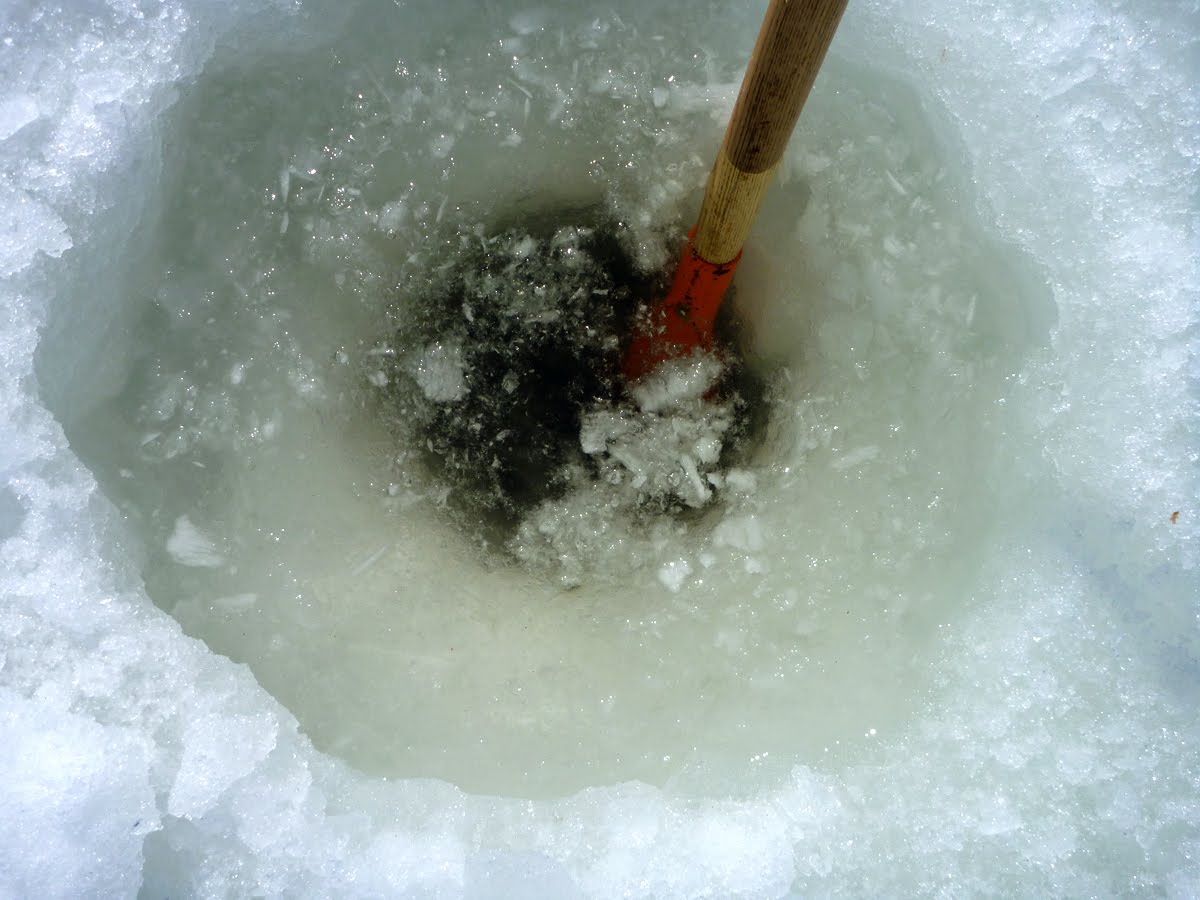
 In the distance to the right you can see my "equipment"'; the solid metal rod and propane torch that turned out to be rather useless as I tried to make a small hole through the ice. A first trial hole, where this photo was taken, hit a rock at 2' 5 ' (29 inches) depth. I went to the east end and "drilled" where you see the rod in this photo but the top-most layer of snow on the lake was melting rapidly and covering the lake surface with 3-4 inches of water. My downward progress stopped. The melt water filled the hole when I retracted the bar and reheated it, then cooled immediately when it was immersed in the water again. I continued hammering but to little avail. Probably and manual drill or auger would be more productive.
 This shows the extent of the melting of the snow on the lake surface that occurred by noon.
On January 30, 1940 Slim Harris cut through 39 inches of ice in the area to the left in this photo and found 6 feet of water. I'm curious, as at Lonesome Lake, how much the thickness varies from year to year. And, if it varies, does the thickness of the ice reflect seasonal temperature changes. In his write up in Appalachia (December 1940) Slim wrote that alpine lakes greater than 6 feet in depth do not freeze to the bottom. "The density of the water at near freezing temperatures increases. Maximum density if reached at 39 degrees (F). In the fall the surface water cools and sinks. Warm water near the bottom rises. It gets cooled but the surface water drops below 39 degrees (F) and becomes lighter. It stays near the surface and later freezes. The second layer down, what had originally been warmer water near the bottom forms a layer of insulation under the ice." p. 113. The implication is that the thickness of the ice will reflect average temperatures through the fall and winter for any given year.
 Solar heating of these rocks was melting the ice but only on the north side of the lake that receives much more sunlight.
On April 20, 1940 Slim along with Uncas (Paul) Gerhard again measured the ice on the larger lake and it was still 39 inches thick. They cut a hole through the ice on the smaller lake and measured it at 43 inches thick but discovered that there was no water under the ice. The small lake is only 4-5 feet deep.
 Mt. Monroe reflected in the lake. The surface water was getting deeper by the minute so I abandoned my efforts and headed back to the hut and my lunch.
 Snow cover in the vicinity of the hut is sparse and may indicate a dry spring and possibly a dry summer coming.
 Comparing this photo from just below the summit of Monroe taken early Sunday afternoon with the one below taken two years ago dramatically illustrates variations in snow cover. This is not to say winter is over on Mt. Washington. Historically snow can accumulate here right into early May so this scene could look far more wintery two weeks from now.
 Same scene March 6, 2010
 Looking south into the Saco River Valley with Mt. Kearsarge in the middle distance on the left, the Moats just behind Attitash ski area on the right and Oaks Gulf in the foreground.
 Krummholz that has adapted to this niche by hunkering down.
 Bare ground means more frost action impacting the soil which, depending on the slope, creates these kinds of cracks in the surface.
 Diapensia, Bigelow Sedge and Hair Cap moss getting some March sun. If the present snow conditions continue with a lot of ground exposure it may alter the flowering dates of the alpine flowers. It will be interesting to see. As noted, plants in Western Massachusetts are flowering 3 weeks a head of schedule due to a lingering heat wave. Temperatures in the alpine zone have also been above average for the past week.
 Speaking of alpine plants, these ski tracks are crossing a large gravel bed where dwarf cinquefoil grows. The lack of snow cover around the hut and on Monroe means the barren ground is taking a beating from skiers and hikers this spring which raises the possibility of damage to plants.
 Mt. Lafayette and the Franconia Ridge in the distance over the Twin Range (North Twin has the large slide scar).
 The descent was unbearably hot even with a good breeze and the snow and ice were breaking down to a watery slurry that was slippery.
 The lovely Ammonoosuc. The river rose by a foot in the course of the day accounting for a lot of snow-melt water coming off the ridge.